|
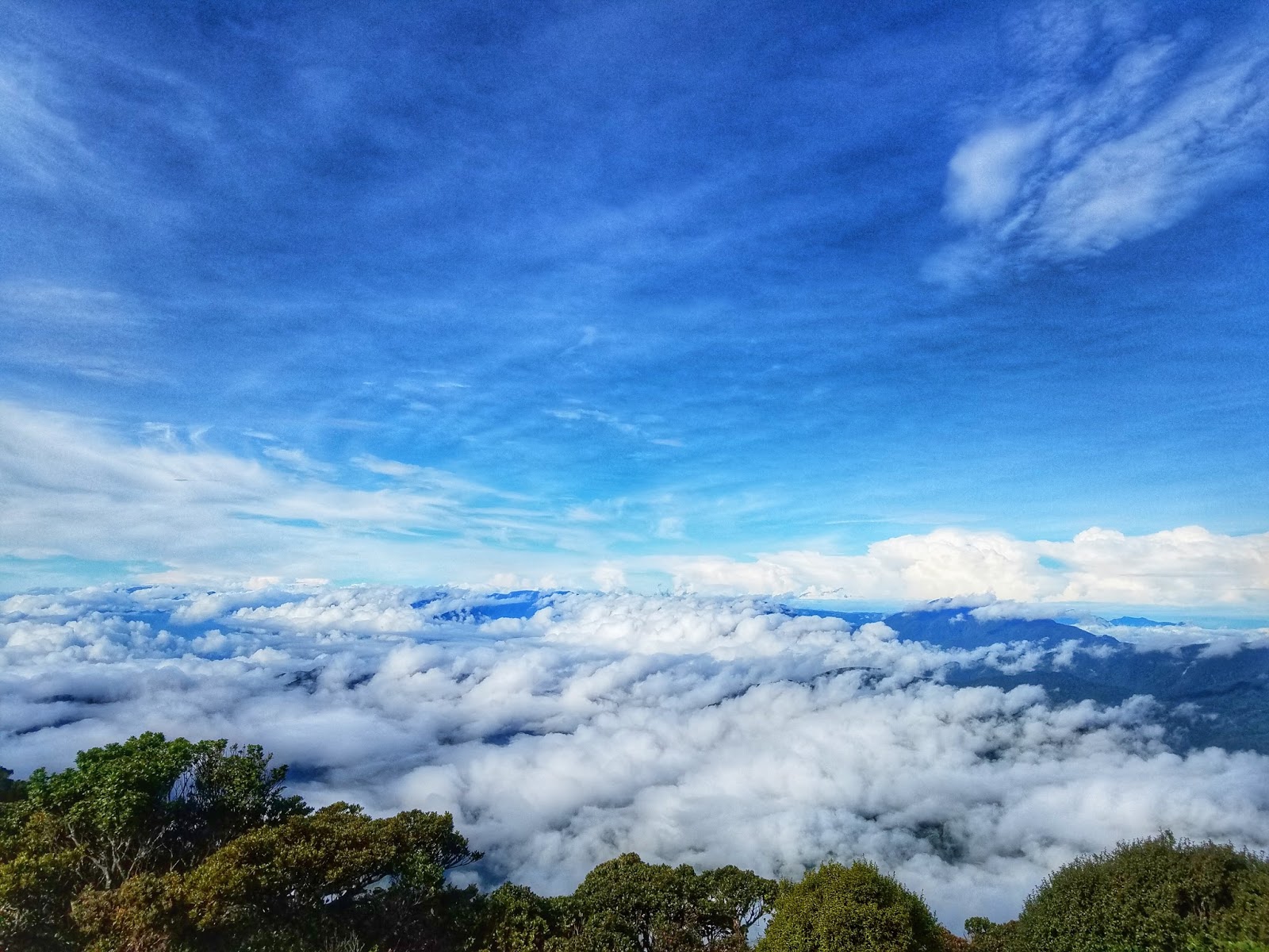
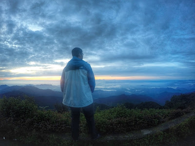
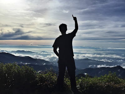
| Majestic sea of clouds as viewed from the summit of Mt. Amuyao |
MT. AMUYAO (BARLIG-BATAD TRAVERSE)
Great Cordillera Traverse
Mountain Province and Ifugao
Entry point: Sitio Macalana, Barlig, Mt. Province
Exit point: Batad Junction, Banaue, Ifugao
LLA: 17.0123N, 121.1297E, 2702 MASL (#10)
Days required / Hours to summit: 3-4 days / 5-7 hours
Specs: Major climb, Difficulty 8/9, Trail class 1-3
Source: pinoymountaineer.com
Mt. Amuyao is considered as the 10th highest mountain in the Philippines. Mt. Amuyao Traverse is considered as one of the three Great Cordillera Traverse, together with Mt. Ugo Traverse and Mt. Napulauan Traverse. Based on Pinoymountaineer.com, Mt. Amuyao Traverse is the most difficult among the three which requires 3-4 days of hiking which starts at Barlig, Mountain Province up to the summit of Mt. Amuyao, descent to Patyay Village, another uphill battle and long crazy descent to Cambullo Village, and a final push towards the exit of Batad, Ifugao where you can see the Unesco Heritage amphitheater rice terraces.
The entire Amuyao Traverse can be describe in one word,
DIFFICULT. The entire traverse is a crazy difficult 30 km trek through treacherous terrain, uneven surface, unending steep ascent and descent that will make you think why the hell are you embarking on this trail. This traverse will measure how really strong you are physically, mentally, emotionally and spiritually. Do not attempt to go to this place if you are not really well prepared as I am very sure that you will really have a hard time to complete this epic trail. I will share to you the hardship, misery, triumph and success of our entire team.
 |
| Trail Map of Amuyao Traverse. Photo credits to Nomad Terra Crawlers |
 |
| Stopover at the Banaue Tourism Center |

 |
| Registration at the Barlig Police Station |
Route: Barlig, Mountain Province to Batad, Ifugao
Day 1 - Barlig,Mountain Province (entry point) to Summit of Mt. Amuyao
Total estimated hiking time - 6 to 7 hours
Estimated length - 7 km
 |
| From the main road, we descended to the town of Barlig |
 |
| Town of Barlig, Mountain Province |
 |
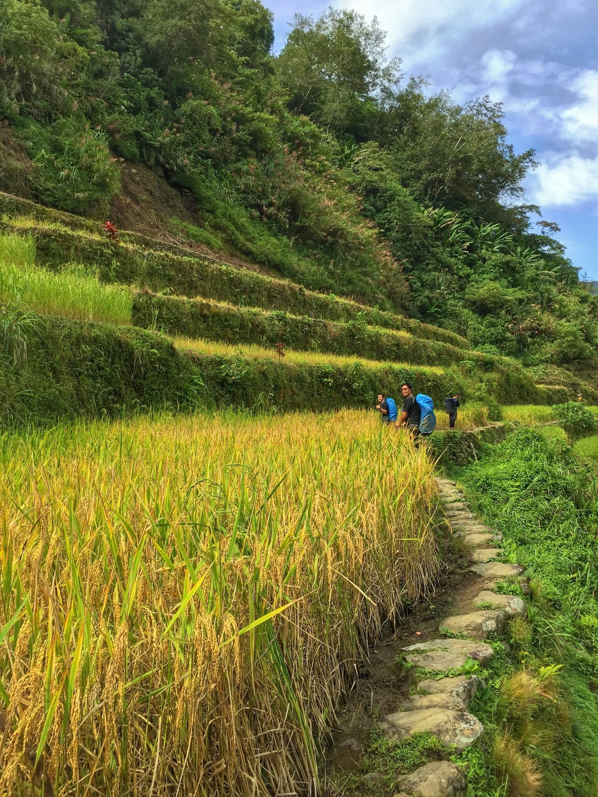
| The start of the hike is through the Barlig Rice Terraces |
There is a bunkhouse at the summit, you'll just have to hurry since it is on a first come first serve basis and can only accommodate a certain amount of people maybe 12-18 persons. We are somehow lucky since we're the only team back then so the bunkhouse was all ours.
 |
| Entrance to the summit of Mt. Amuyao. The summit hosts the ABS-CBN and GMA tower and some bunkhouses. |
Overall, Day 1 was tough. We just took a quick dinner and went to sleep early. No socials since we're all dead tired. Sleep well on your first day since the second day will most probably be the most hellish and nightmare trek of the entire traverse.
Day 2- Mt. Amuyao Summit to Patyay Village to Mt. Umayao to Emergency Camp (Ideally, day 2 should end in Cambullo Village)
Total estimated hiking time - 10 to 12 hours
Estimated length - 12 km
 |
| Can you see the white structures? Those are electrical posts which can be seen from the entry point 'till summit. |
 |
| Basekamp Team Amuyao |
 |
| The Voyagers |
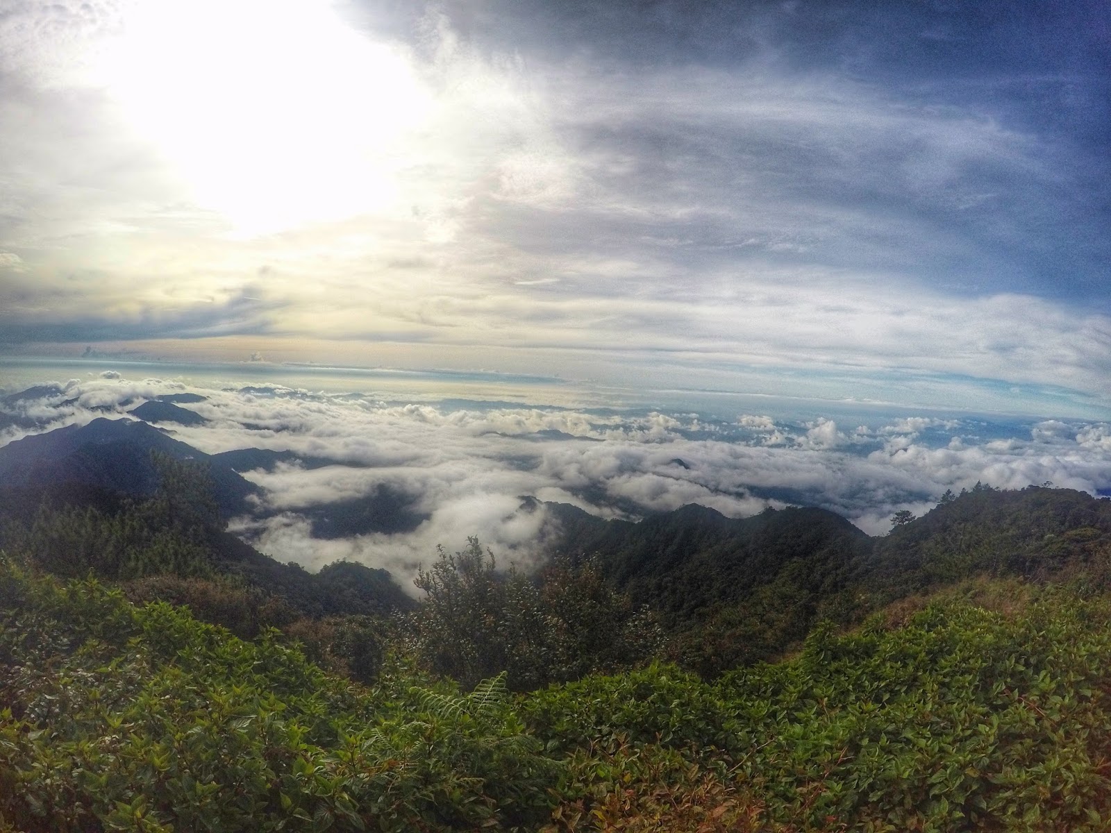
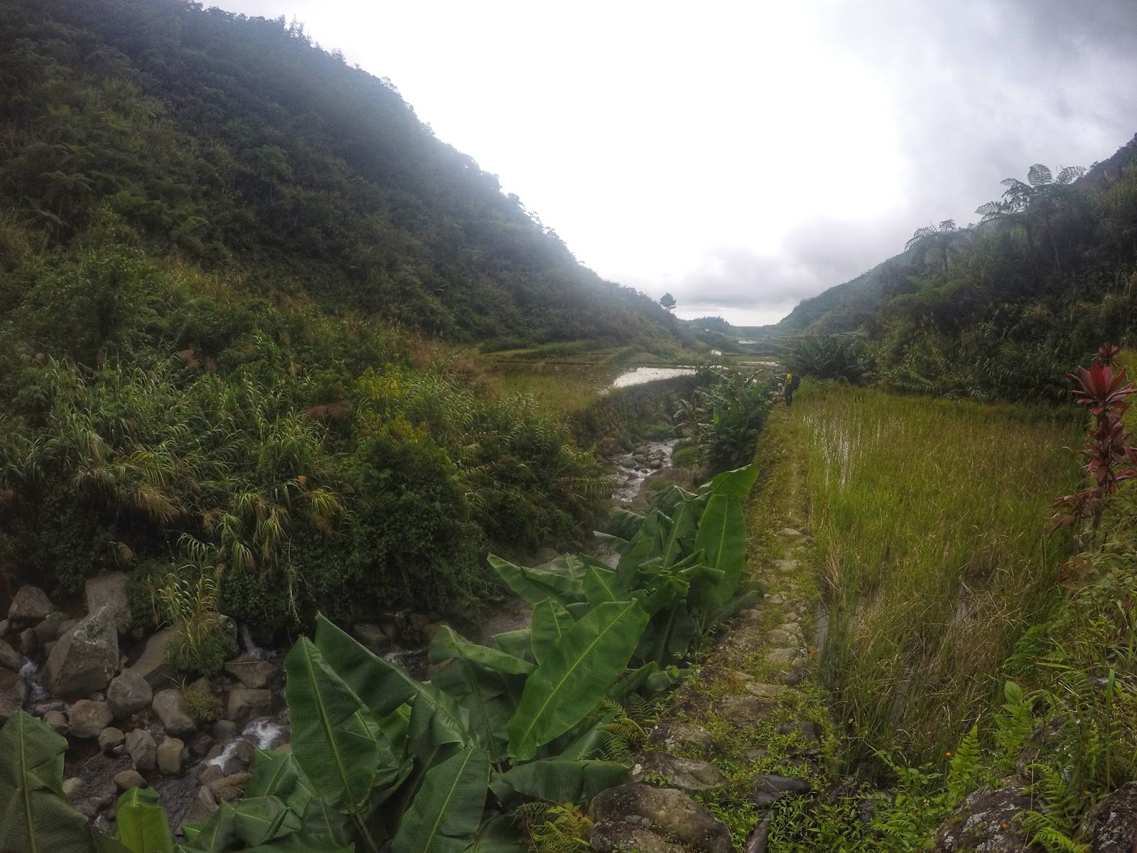
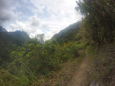
Summit to Patyay Village - Started our descent at around 8:00 am. The hike will start on a steep and deadly ridge facing south. Deadly because the left side is a very deep cliff and single misstep will surely be fatal. However, this portion also offers outstanding views of the sea of clouds. It's like you're walking through the clouds. Afterwards, you'll be entering the mossy forest of Amuyao. In my opinion, it is not as beautiful as the mossy forest of Pulag Tawangan trail but still pleasant. The descent is steep but manageable, maybe moderate but not yet difficult. Midway, there is another waiting shed with a water source on its back. However, the water source is far and difficult to go to. After maybe an hour, a grassy terrain will emerge which leads to a river and the entrance of the rice terraces of Patyay Village. We arrived at Patyay Village at around 2:00 pm. Be sure to rest here and hopefully you arrive before noontime. If not, try to assess if you still have the strength to move forward to Cambullo Village. For me, the trek to Cambullo Village from Patyay is the hardest part of the entire traverse because of its length and difficulty.

 |
| Steep knife edge ridge going down from the summit. Left side is a deep cliff. |
 |
| Mossy Forest of Mt. Amuyao |
 |
| Entrance to the rice terraces of Patyay Village |
 |
| Patyay Village |
Patyay Village to the summit of Mt. Umayao
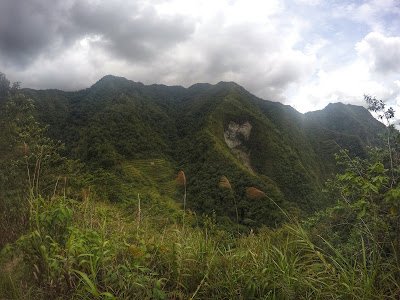
I really hate this portion because this is so effin difficult. The trail is almost vertical, almost destroyed and very very muddy. I still have lots of energy when I left Patyay Village but it was depleted very fast because of the very difficult ascent to this mountain. I used my hands a lot just to grab on to whatever leaves or branches there were for me not to fall. Most of my cuts and bruises were from this trail. I was the last one to arrive at the summit of this forsaken mountain with its forbidding incline. My legs were on the verge of cramping so I took baby steps. Maybe it took me almost 2 hours just to get to the summit. Actually, I was so dead tired that I stopped talking. I just wanted to sleep but I knew that the next village was still very far. We rested a bit and continued our descent.
Summit of Mt. Umayao to Emergency Night Camp
I thought the ascent was already effin difficult but my God I was so wrong. The entire descent of this hellish mountain was very very brutal. Our descent was characterized by very unstable, muddy and slippery terrain. There were lots of portions with loose rocks. There were also lots of portions where no firm foot or handholds. We exercised extreme precaution just to get out of this trail. I think difficult is an understatement for the descent that we experienced. Almost all of us slid, because we really cannot stand firmly. It was a lot safer for us to just slid down. On my part, I also had several slips that almost made my heart jumped because I stumbled on the side of the cliff. I can still perfectly remember how my life flashed in front of my eyes. I was in a state of shocked when that happened and it took me a couple of minutes before I decided to stand and continue. The descent was so long that we were able to get out of this miserable mountain trail at around 7:30 pm.
We stopped and just decided to rest and sleep at the rice pilapils. We cannot continue because we were so very very tired and we do not know how to proceed to the trail without a guide. Our guide was with another person since she had a minor injury so they were quite far behind from us. We were very concerned about her because we knew that the trail will be very hard for her. While we were lying on our back, we were having conversations if we would still push through. As for me, I cannot go on to the next village, I told them that it's better for us to proceed to the nearest hut or home, rest and just start early on the next day. We all have the same thoughts, I guess they're also very very tired. We also debated whether the lights we saw were from locals moving toward our locations. Some of us saw it us lights from people while some from fireflies and yes they were from fireflies lol. The guide together with our companion finally arrived at our resting place afters 2 hours of quick nap and rest and some reflection session regarding the difficulty that happened on the second day.
After a quick deliberation on how we'd proceed, we continued our hike at close to 10:00 pm through walking on the unstable stones/pathway of the rice terraces. Who in their right mind would hike at 10:00 pm?!! Haha everyone was already sleeping and yet we were still continuing our trek at that time. A wrong step would send anyone of us plunging to the lower muddy level probably at a height of one floor of a building. Walking through this portion at night time is really not recommended. Finally, we arrived at the emergency shelter at around 11:00 pm. We ate a very delicious dinner made by my friend at 12 midnight and went to sleep by 1:00 am. Finally, a good sleep is the culmination of the hardship we experienced on our second day.
 |
| The "pilapil" team. Yes, we are the ones that slepts for 2 hours on the pilapil.. |
Day 3 Emergency camp to Cambullo Village to Batad, Ifugao (exit point)
Total Estimated Hiking Hours - 3 to 5 hours
Estimated length - 11 km
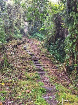
We started hiking at around 9:00 am., The trail was a lot easier as compared to the previous days. No more hellish assaults, just gradual descent through concrete stairs and the rice terraces 'till Cambullo Village. We arrived there at around 11:00 am. Surprisingly, the lead climbers were still there when we arrived haha.
 |
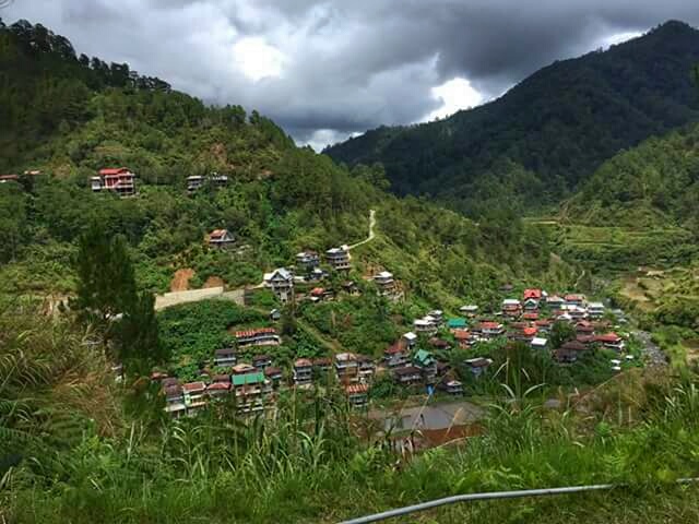
| There it is! Cambulo Village! |
 |
| Hanging bridge before Cambullo Village |
 |
| Team Amuyao Traverse complete at the Cambullo Guest House |
All of us continued the slight ascent to Batad Rice Terraces. It was moderately difficult because of the concrete stairs again. I hate these stairs haha! Finally, we arrived at the viewpoint of Batad Rice Terraces. a UNESCO heritage and it was just so beautiful. Took some quick rest and photos and finally arrived at the village. All of us thought that the exit road was near so we decided to eat lunch. Afterwards, took the last ascent to the exit road where our rented jeepney with our other companions were waiting.
 |
| Trekking through the rice terraces going to Batad |
 |
| Batad Rice Terraces, a UNESCO World Heritage Site |
 |
| Exit point, Batad, Ifugao. Traverse Completed. |
Overall, this is a very humbling and memorable experience. I did not expect that I'll be able to complete this course because honestly I am not well prepared during that time. This is the toughest climb that I've ever experienced but certainly this is also the most beautiful. This mountain with a difficulty level of 8/9 is really no joke. This entire traverse is not for the weak. You should have the heart and the courage to never give up so that you can finish this course.
Even though this is a very difficult climb, I still want you to experience this trail since the rewards are just mind blowing. Standing at the summit of the 10th highest mountain in the Philippines while watching the sea of clouds roll in is just a once in a lifetime experience. Watching the fiery sunrise after a very cold and rainy night is just spectacular. You'll be able to go deep into the heart of the Cordillera with this traverse. You'll be able to immerse yourself with nature and the locals and appreciate their simple life. You'll be able to see the UNESCO heritage site, the Batad Rice Terraces in persons not just in books. A very unique artwork of our native Filipinos that cannot be found anywhere else in the world.
You will emerge a new person after you complete this traverse. You'll appreciate life more and care about your comrades more. You'll be able to surpass your limits and know yourself more. All the pain, frustration, upset, excitement, fear, satisfaction will make you a better person. I tell you to also try this trail and definitely you will receive a high sense of fulfillment in your climbing career. Break your boundaries! Explore more! Advance congratulations to you! I completed it and I know you'll be able to complete this trail also!