
MT. BALINGKILAT TRAVERSE TO NAGSASA COVE
Subic, Zambales
Jumpoff: Sitio Cawag Settlement, Subic Town
LLA: 14.89 N, 120.11 E (est.), 1100 MASL
Days required / Hours to summit: 1-2 days / 4-6 hours
Specs: Major Climb, Difficulty 6/9, Trail class 1-4
Budget Breakdown

Sample Itinerary

How to go to this place
You should coordinate first with the Cawag Chieftain Balosbalos so that he can arrange your guide and for him to know the details of your climb. Signal is scarce in Cawag so please be patient in contacting Chief Balosbalos. Ride an Ologanpo, Subic bound bus from Victory Liner Cubao. Last bus to Ologanpo is I think around 11:00 PM then it will resume the trip at 2:00 AM. Call the Victory Liner Cubao station for the updated trip schedule. Disembark at the Olongapo Terminal and take your breakfast here because there are lots of fast food restaurants and eateries near the terminal. Afterwards, just wait for your rented jeep or van here. It is a lot easier if you'll just rent a jeep or van than commuting to Cawag. Rates are higher a bit if you'll arrive at Ologanpo by midnight. Tell the driver to drop you at the Subic Police Station for initial registration before proceeding to Cawag. Also prepare a letter of intent in 3 copies, one copy to the Subic Police Station, one copy to Chief Balosbalos, and once copy for yourself. Indicate the activity, members of the team and the detailed itinerary of the climb and your contact numbers.
Contact Numbers
Van/Jeep Rental to Cawag - Kuya Diony - 09497015730
Guide - Kuya Noli - 09183271442
Cawag Chief Balosbalos - 09994984811
Boat Rental - Kuya Johnny - 09202224687
Climb Experience
I’ll start this story by asking you a question “When was the last time you did something for the first time?” I think it is just part of human nature to seek something that will make life a bit interesting and exciting. Something out of the ordinary, something that makes every bit of your cells a little energetic and lively than usual, something that will make you feel that you are truly “living” and not just merely existing.
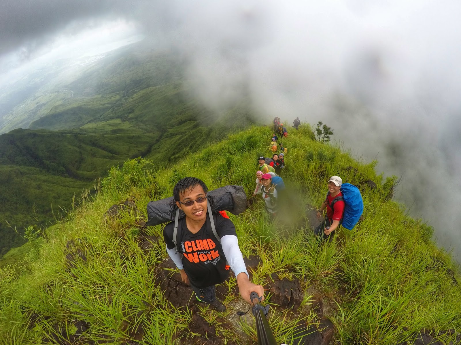
It was a gloomy Saturday, when I did something for the first time again. The activity for that day was to conquer my first major climb in the most imposing peak of Subic. When I started planning this climb, I envisioned clear skies, the blue ocean and lots of stars at night. However, life is really like a box of chocolate, you’ll never know what you’ll be getting.
I was not able to get a decent sleep during our almost 4 hours travel with Victory Liner to Olongapo City, the place where our hired van would be fetching us. We arrived there at around 4 am and ate breakfast at Chowking. There are lots of restaurants like Chowking, Mang Inasal, and Jolibee and eateries near the station of Victory Liner in Ologanpo so you will not be having a hard time in choosing a place to eat. After we ate our breakfast, we rode our hired van to the Subic Police Station near the Subic Municipal Hall to drop our letter of intent. Afterwards, we bought some food supplies at the Subic market which is just near the Municipal Hall. We immediately proceeded to Brgy. Cawag once we're done buying our food supplies. Upon our arrival at around 8-9 am, Chieftain Balosbalos greeted our team and introduced us to our 3 guides. The weather was already gloomy back then. We encountered some light rain showers during our travel to the jump-off area but luckily it stopped when we started our climb proper.
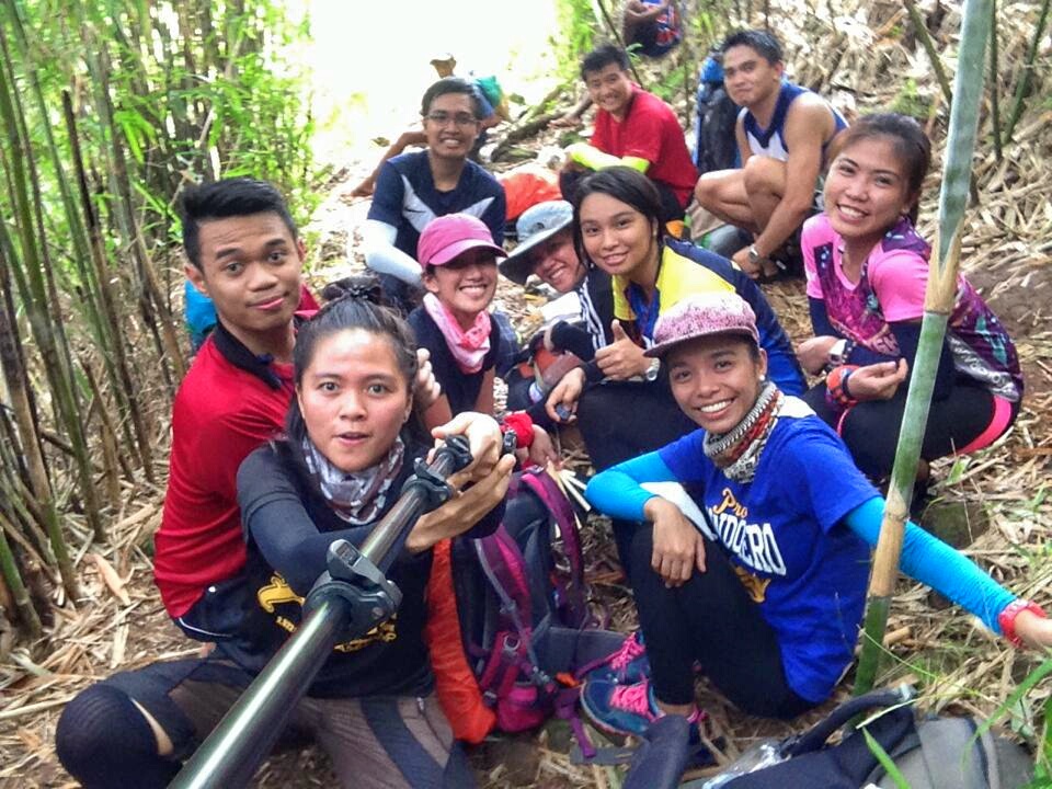
 |
| Team Balingkilat Traverse. I miss you guys! |
The first portion of the trek was relatively easy. After walking for about 10 to 15 minutes, we arrived at the supposed to be first riverbed. During rainy season, this is somehow perilous because it can go as high as knee deep. Luckily, the river was dry during our visit. Mt. Balingkilat is the nearest mountain to Cawag, followed by Mt. Dayungan and the farthest is Mt. Cinco Picos. When you arrive at the riverbed, you'll immediately notice that big bad ass looking mountain which is Mt. Balingkilat.
We decided to have a quick picture taking then continued our trek. You will soon encounter a fork on the trail, going straight leads to Dayungan and Cinco Picos area while the right path is for Balingkilat. It was cloudy that time so it was not that hot but the air was so damn dry. I expected that the air would be cold and refreshing considering that this is a coastal mountain but I was wrong because there was actually no refreshing air that time. The trail is very open with almost no shade so it is best to apply ample amount of sunblock.
 |
| The dry riverbed with Mt. Balingkilat covered by clouds at the background |
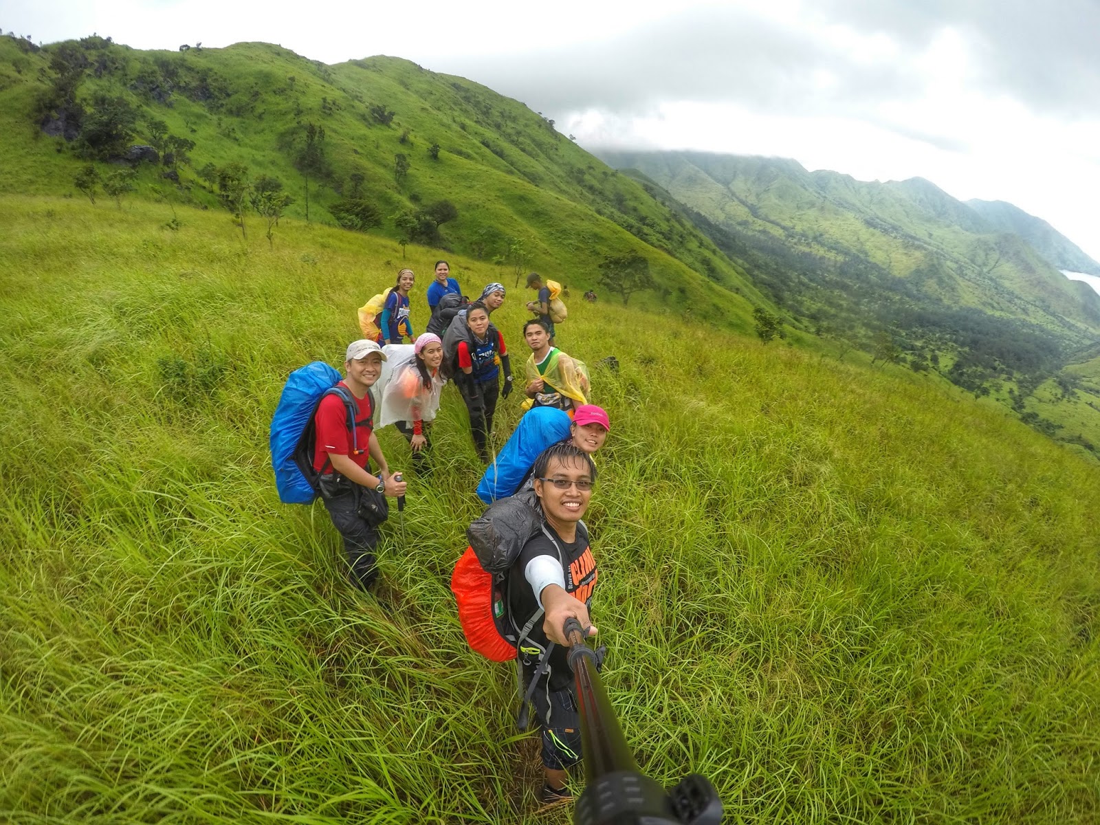
The trail started to change from dry sandy almost flat area to inclined terrain with lots of tall grasses as tall as us lol. As we slowly gained elevation it seems that the place became much hotter.

Finally, we arrived at the only shaded area of the whole trail, the Kawayanan campsite which was named because of the presence of lots of Kawayan or Bamboos. There is a water source here so be sure to refill your water bottles. The next and last water source is at the campsite near the summit which is 4-5 hours away from this area. Due to the intense heat, we stayed for a long time here. Actually, our team discussed if we should just rest and wait until afternoon before continuing the climb so that we would encounter lesser heat or just take a long break and continue the hike in a fast pacing manner.
 |
| Our team at the Kawayanan Campsite |
And finally, we just decided to continue the climb in a fast paced manner. The scenery became more beautiful as our team gained elevation. However, I was not in the mood to take picture because it was just too hot that is why most of the pictures during the early part of the trek for this post were from my team mates.
 |
| No shade. Embrace the heat of the sun lol. |
 |
| I believe this picture was captured at around 12-1 pm haha. |

The trail on the picture above is somehow steep. After the assault portion, we arrived at a flat area as seen below where we took a short break.


Afterwards, we hiked for a little bit to arrive at a more spacious flat area where we ate our lunch and took another major break. Our guide told us, that this area is the last comfortable place to eat our lunch because the trail onward is an all-out assault to the campsite near the summit.

The trail to the campsite followed a somewhat zigzag pattern, lots of steep assaults, lots of tall talahib grasses but still with no shades from trees. We were somehow lucky because when we approached this steep area, it was already a bit cloudy and windy so the heat of the sun was not a factor anymore to slow us down.


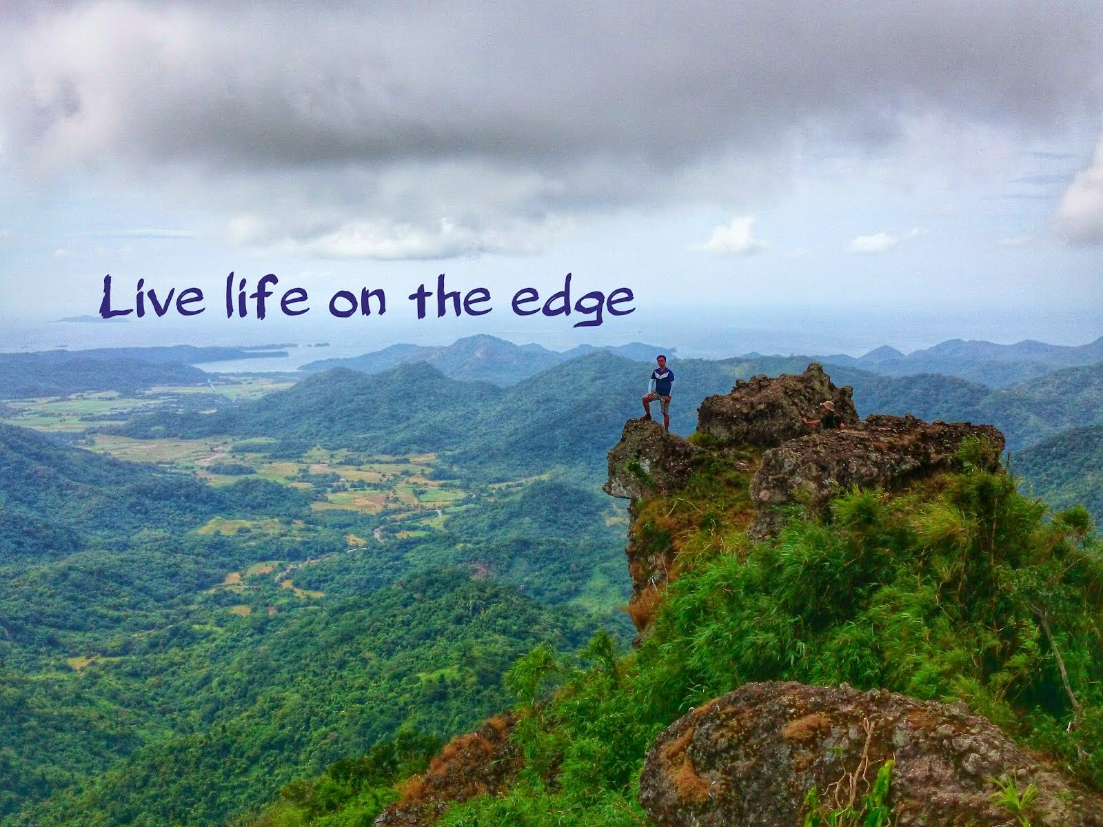
You will encounter a lot of huge rocks with edgy boulders as you approaches the summit area. The view here is already outstanding specially if on a clear day. The campsite is just a few meters from the boulders area.
 |
| Such magnificent view of Subic. |
It was a lot colder when we arrived at the campsite probably at around 4-5 pm. We already noticed that more and more dark clouds were hovering on the sky so we set up our tents as fast as possible and the others started cooking our dinner also.
 |
| Beautiful panoramic shot of a our campsite area by Sir Jansen. Our tent is the white one. |


There is a water source near the campsite which is located on the bushes few meters away.
 |
| Water source near the campsite. It taste very refreshing promise. |

 |
| The summit of Balingkilat hidden behind the clouds |

 |
| The viewing area is characterized by large boulders |
 |
| There it is! The summit of Mt. Balingkilat |
 |
| Loving those curves and ridges |
 |
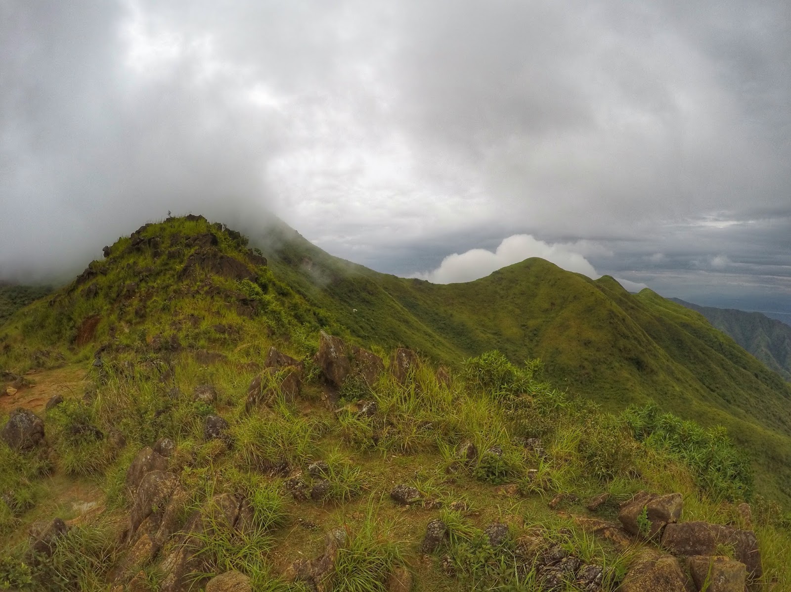
| The campsite with the view of Cinco Picos (pointed peaks left) and Dayungan (rounded peak right) at the background |
We hurried back down to the campsite and ate our sumptuous dinner. I really don't know what happened afterwards haha. We were supposed to have a social night but it seems that everyone was gearing up for bed probably because we're all tired and the cold lured us to sleep. Anyway, we slept early. Then, I woke up at the middle of night because of the heavy rain. It was way too cold because our tent has no groundsheet or flysheet. I also felt that the water was already leaking inside our tent so I had to seal it with a towel. I think the heavy rain lasted throughout the night. Here is the funny yet crazy story of that night. At around 4 in the morning, I felt that my stomach was aching so bad. There was no other option but to let it out lol. So at the middle of the night under a heavy rain, I went outside the tent with my poncho on. Boy, it was cold and very uncomfortable to find a "sweet spot" where you can do your thing. In the mountains, you cannot just poop anywhere you want, you should dig first and cover it afterwards. The funny thing was that the soil (I believe it is clay soil) was just too hard to dig. I had a hard time digging because of the heavy rain. Thankfully, I was able to pull it off and the rest was history haha.

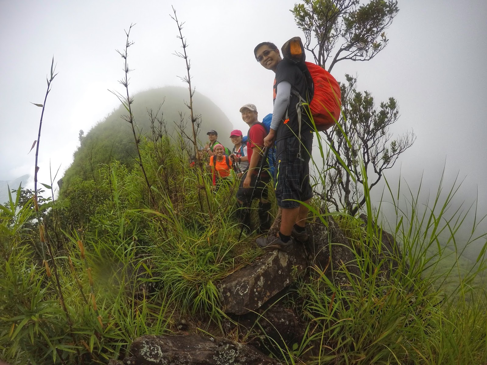
We woke up at around 6 am and there was just this thick fog all around us haha. I was a little bit disheartened because I knew at that time that there would be no clearing for us. We're supposed to have a sunrise at the summit but because there was no clearing we just cooked and ate our breakfast first. Afterwards, we proceeded to the summit which took us about 15-20 mins hike from the campsite.
 |
| Up we go! Here is the the summit assault! |

As expected, there was no clearing at the summit haha. The fog/cloud was just too thick and the visibility was poor. Even though there was no view, I was still proud that I made it to the top of the highest peak in Subic. We only spent a few minutes at the summit to take some photos and hurriedly went back down to the campsite.

We already packed our things before going up the summit so it was just easy for us to start our descent to Nagsasa Cove. The weather was kind of bad at that time due to the enhanced southwest moonsoon or Habagat. We cautiously approached the knife edge ridge because of poor visibility and the heavy rain. Unfortunately, I still slipped twice even though I was careful because the boulders were just too slippery. The knife edge ridge was really dangerous due to deep cliffs on both sides. On a clear day, you will really see how dangerous it is. Honestly, it was not that scary for me because I cannot see clearly that time lol. I disliked the Poncho that I brought because it was not comfortable so I decided to just embrace the rain. It was refreshing but at the same time annoying because the water was running through my eyeglasses which blurred my vision.
 |
| I think this is the steepest and scariest part of the knife edge ridge. Almost vertical descent lol. |


We were able to get a quick glimpse of our trail when the clouds started rolling away. We were still at a high elevation but I think the picture above and below were the end part of the knife edge ridge so there's no more scary and dangerous portion.


The mountain at the background of the picture above is I think Mt. Bira Bira. In order to arrive at Nagsasa Cove, you'll have to do a rightward descent on the connecting ridge to Mt. Bira Bira

The picture below shows our team descending on the rightward portion of the connecting ridge to Mt. Bira Bira. Finally, the rain subsided and so was the thick fog. The Nagsasa Cove can now be seen clearly but from our place on the below picture, it was still quite far.


From the connecting ridge to Mt. Bira Bira, it was just an easy but long descent to Nagsasa Cove. There are some river crossing to Nagsasa Cove so be sure to check if it is passable specially if it raining.


Finally, we arrived at Nagsasa cove at around 2-3 pm after almost 7 hours of descent. We rested and enjoyed our remaining time. There are stalls here that sell drinks and some snacks. There are also comfort and shower rooms. The beach here is really good place to swim because the water is not deep and the sand is very fine.


We left Nagsasa Cove at around 4 pm. Nagsasa cove is the second farthest cove from Pundaquit (2-3 hours boat ride), Silanguin Cove being the farthest (3 to 4 hours boat ride) and Anawangin being the nearest (1 to 2 hours boat ride). Honestly, I think everyone of my teammates would agree to me that the boat ride was the highlight of our entire climb haha. Never ever venture out to the sea of Subic during a bad weather because the sea here can be very rough. When we sailed out, the sea was still calm but we soon encountered a heavy thunderstorm that scared the shit out of us haha. It was way too scary, there were several times that we thought our boat would capsized because the waves were just crazy. I was already imagining back then that we're already floating on the ocean while our bags were slowly sinking at the bottom haha. I was already praying hard and thinking how to survive at the sea haha. I thought I was the only one thinking that scary things but later on when I asked them, they were also thinking the same thing haha. I believe that was the scariest experienced I've had at sea and I will never ever want to experience that again haha. We were so thankful that our boat arrived safely at Pundaquit after more than 2 hours of terrifying boat ride. Even the boatman told us that he was worried also haha.
