

Mt. Makiling Traverse via Sipit Trail
Sto. Tomas, Batangas and Los Banos, Laguna
Entry point: Sitio Jordan, Brgy. San Miguel, Sto. Tomas
Exit point: UP College of Forestry, Los Banos, Laguna
LLA: 14.13°N 121.20°E, 1090 MASL (Peak 2)
Hours to Peak 2 / days required: 1-2 days / 5-8 hours
Specs: Major climb, Difficulty 5/9, Trail class 3 with roped segments
Features: Roped segments, rocky face, limatik, rattan, tropical rainforest
Budget Breakdown

Sample Itinerary

How did we got here?
We rode a Jac Liner bus in Gil Puyat bound to Lucena and alighted at Brgy. Felix, Sto. Tomas, Batangas. We got off the bus at the Seaoil Gasoline Station. Rode a tricycle near the 7-11 and told the driver that we were going to the Makiling Eco-Park. We registered (no fee) and got a guide for a negotiated fee. There are comfort rooms here so you can do your stuff before starting the climb.
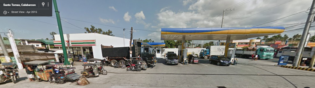
This is the place where you should disembark.
Climb Experience
This was the second training climb for our Mt. Pulag expedition. Supposedly, the number of participants were supposed to be more than seven but due to the election which took place the day after this climb and the sudden change of mountain, our group's number went down to four. There were lots of people lined up when I arrived at the bus station so I thought that we might be late with our schedule. Luckily, the arrival of buses and the travel to San Felix were fast. When we got off the bus, we noticed a pair who looks like they were bound also to Makiling. They approached us so our mini group expanded. We went to 7-11 and bought some provisions. Thereafter, we rode the tricycle to Makiling Eco-Park. Kuya Mitchel was the one who negotiated the guide fee to P800 from the normal amount of P1000 for 5 persons. Our guide told us that he will only accompany us down to Aguila Base since it will be more costly for him to go all the way down to the Los Banoz side and go back to Sto. Tomas. After a few chit chats, we now started the training climb.
 |
| Kuya Mitchel with his partner ate Kathleen |
The start of the trail was very easy and we just followed the rough road that led to the open fields with large pipelines from the Makban Geothermal Plant. We took some group photos with the wide view of Mt. Makiling at the background.
 |
| The members of Team Patag which are also the participants for the Pulag climb. |
 |
| Off we go! |
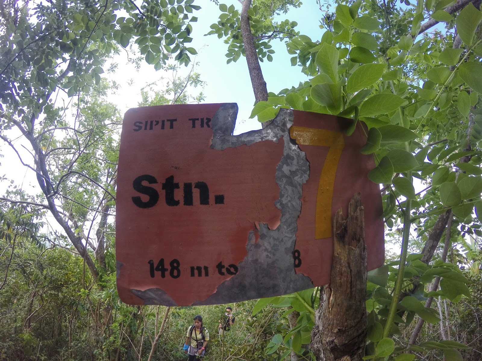
The whole trail has only one water source which can be found somewhere near station 2, about 20-30mins from the trail head so bring enough water if you'll be doing the traverse. The trail has several marker stations so you should just check it from time to time. Station 1-4 is beginner friendly with few ups and downs. It was very humid and hot when we did this hike so I was already sweating heavily and settled for a somehow long break at Station 4 which has a hut and a comfort room. Since it was still summer time, we did not encounter any single limatik all through-out the trail. We met 2 DENR surveyors who were also about to go up to check the condition of the mountain.


 |
| Station 4 where we had an extended break. |
The real challenge will start from Station 5 until Station 15 campsite. As soon as we left Station 4, we encountered steep assaults. There were several ropes and lot of trees to hold on to so do not be afraid. I can say that the hardest portion is from Station 5 to 7. We rested at Station 6 after a tiring assault and Station 7.
 |
| Hello there! This part is the tiring assault to Station 6 |
 |
| Station 6 where we took a rest. |
 |
| A short open section before station 7 where you can have photo ops :) |

 |
| Station 7, another well deserved rest :) |


After Station 7, we continued our pace and the trail became less steep. The trail is pretty much covered by tall trees so there were no viewpoints. We took another major break at station 10 where we bid goodbye to the 2 DENR surveyors that we met.


The trail from Station 11 to Station 15 is mostly descending. I honestly do not like sudden drop in elevation since it means that large elevation gain will soon follow. The trail was somehow easy and by few minutes after 10AM, we were able to reach Station 15 where we took our lunch and had a break. This place is really the stop over for many because after this, grueling assault until Peak 3 (Station 20) will commence.


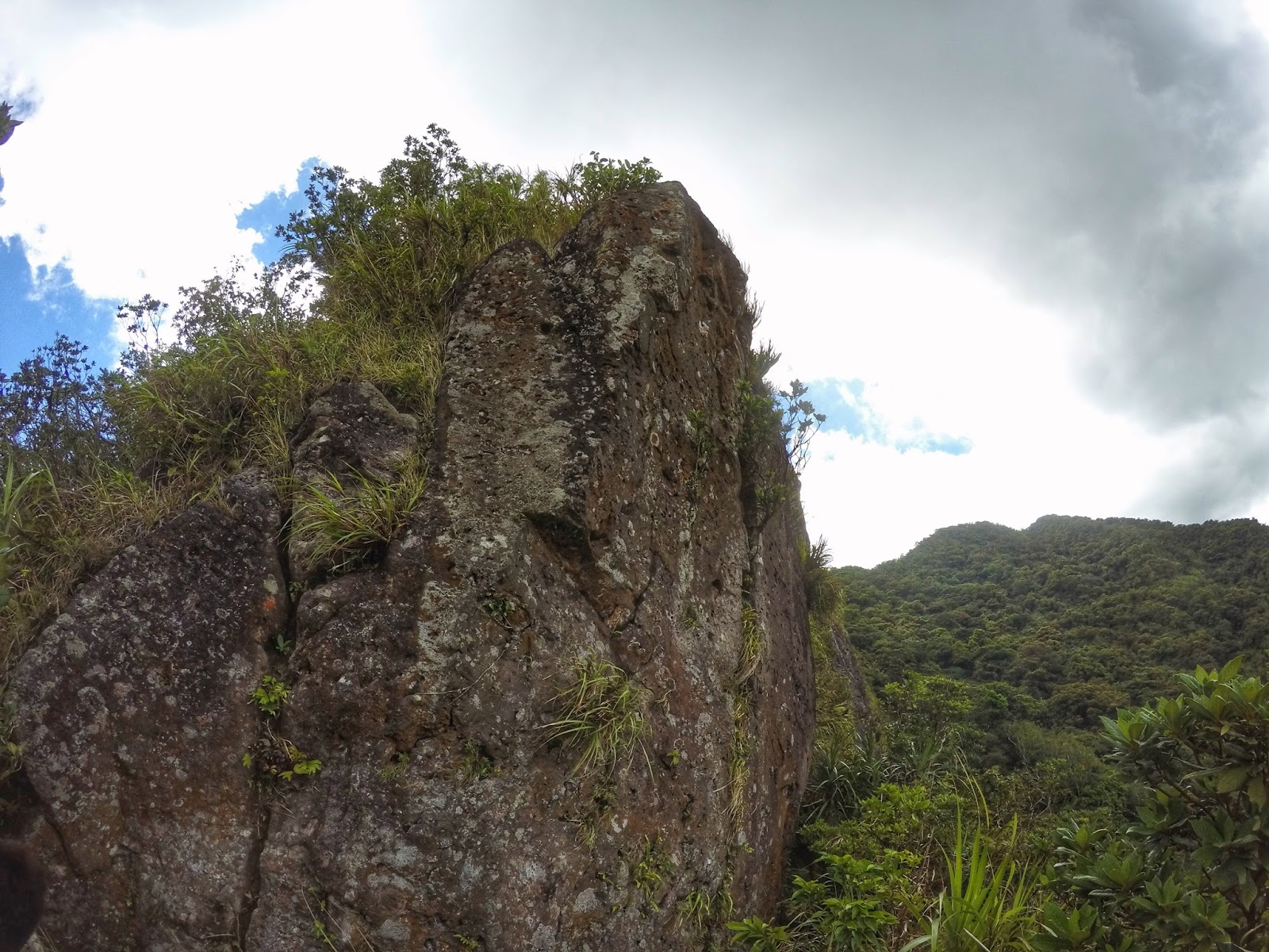
After about 45 minutes, we continued our climb and holy cow, the trail went steep. It was really steep that I had to stop for a couple of times. It was somehow a blessing that there were lots of persons lined up the trail because we will not be in a quick pace. I was not aware how dangerous the trail going to Peak 3 is until I arrived in a small open area where there was a cliff on the left side and an intimidating rock wall on the front. This was where we had a bottleneck since only one person at a time can cross the trail via holding into a rope. I think there were 5-6 rope segments from Station 15 to Peak 3. I honestly hate rope portions because I am afraid that I might release my grasp so it took me some minutes before I decided to start holding on to the rope.
 |
| The first rope segment can be found on the left side of this rock wall hidden by the grasses |
 |
| Trust the rope and do not look down :D |
 |
| Another short rope segment |
 |
| The longest and most difficult rope segment |
The photo above is the most difficult rope segment of the entire trail because of the steepness and the loose soil. The plants on the left side are not strong enough to support your weight so you really have to rely on your upper body strength in order to maintain your grasp on the rope. This will continue up to Haring Bato section where you'll encounter 2 parallel ropes to lift you higher safely. We exercised extreme caution on this part, which was also called as the Melkas Ridge, because of the dangerous cliffs on both sides. Afterwards, we were rewarded with stunning and awesome view of the lush forest of Mt. Makiling from the viewpoint in Melkas Ridge.
 |
| Behold! The breathtaking view from the Melkas Ridge |
 |
| Carefully maneuvering the trail of Melkas Ridge with visible deadly cliff on the left and obstructed cliff on the right. |
 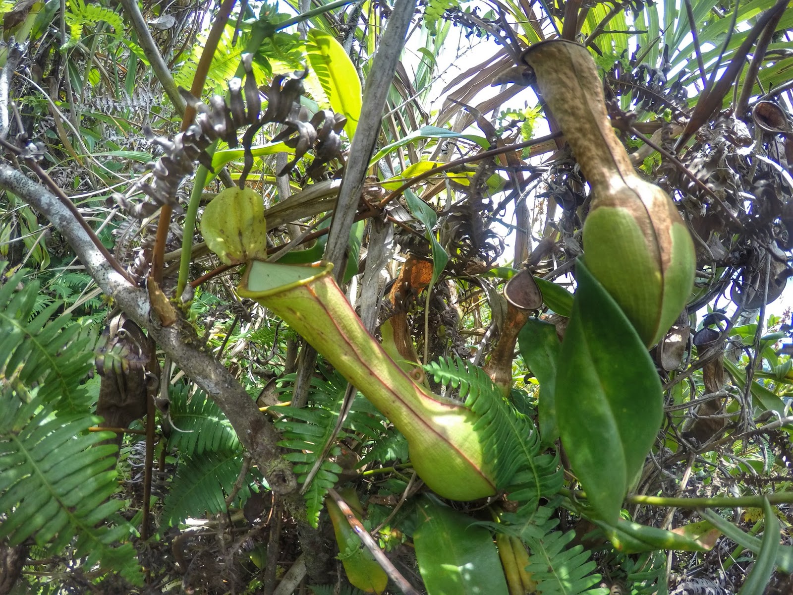 |
| There are pitcher plants on Melkas Ridge!! So awesome! |
 |
| You can see Sto. Tomas, portion of Laguna de Bay, Mt. Maculot (right side near lake) from Melkas Ridge |
 |
| 2 more stations! |
 |
| Some pink plants/flower along the trail |
After almost 4 hours from the jump-off area, at last our group arrived at Peak 3 (Station 20). We took a couple of shots, rested a bit then went ahead to Peak 2 (Summit).

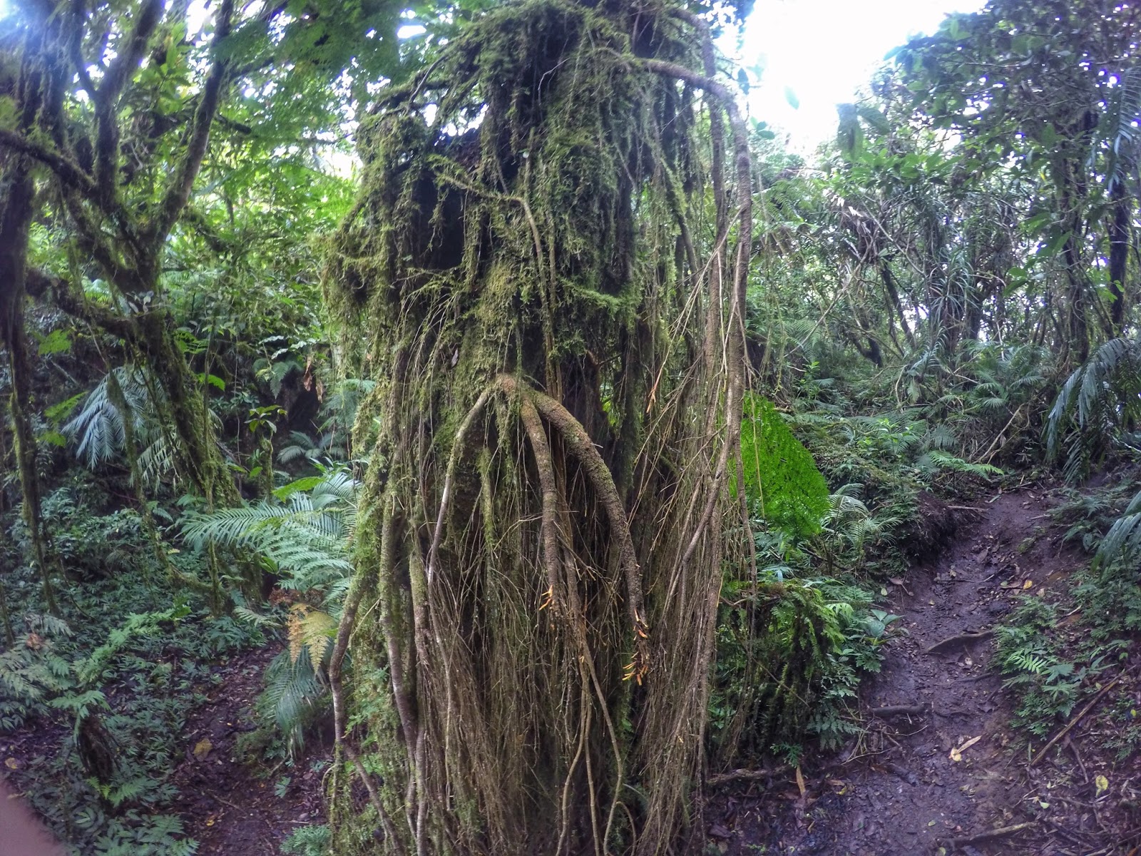
The trail to Summit from Peak 3 was called "Wild Boar Trail" because it was narrow and there were lots of obstacle courses. This portion was also difficult for me because it was a rolling terrain, lots of ascent, then followed by a short steep descent. There were instances when I had to ducked and maneuvered myself so that I could fit on the mazes and tricky trunk openings. Because I was so slow, I was left at the rear with no one around me. I stopped and I was amaze that I was in a mossy forest, my first mossy forest encounter. Afterwards, there was this confusing fork where I took the right path. I walked and walked through the thick and creepy mossy forest but it seems I cannot catch up with the others. I stopped again and thought that I was already lost so I used my whistle and blew hard but I did not get any response. Then I shouted, used my whistle again, shouted, and this went for a couple of minutes until I heard a voice from afar. I hurriedly followed the voice until I reached kua Mitchel who also went back to check me. I was so relieved that I reached them and I hastily followed until I finally reached the summit.

 |
| Yes! I made it to the summit after a some series of tiring cardiac assault |
 |
| Group photo of our Makiling team |
We started our descent at around 1PM. The first hour of descent was painful because it was steep and the trail was muddy and slippery. Afterwards, the trail shifted to a much easier gradual descent until we reached Aguila base (Station 12) at around 3PM. We rested, drank fresh buko juice and rode the habal habal for about an hour until we reached the entrance of the park at UPLB.
 |
| My last picture of the Makiling forest captured on board the habal habal. |