Sunday, November 30, 2014

2nd Climb - Mt. Batulao via New Trail

It has been a while since I updated this blog and since I am a bit laid back today, might as well tell you about our trip to this gorgeous mountain. As i can recall, this mountain captured my interest because of its jagged peaks and vibrant scenery so I suggested this to my seniors at our workplace and in a snap of my finger we had already planned to reach its summit. This climb occurred last February 23, 2014.


Mt. Batulao
Nasugbu, Batangas
Jump-off point: Evercrest Golf Course, Nasugbu
LLA: 14.0408 N 120.8011 E 811 MASL
Days required / Hours to summit: 1 day / 2-4 hours
Specs: Minor Climb, Difficulty 4/9, Trail Class 3 with 60-70 degrees assault
Features: Open trails, rolling slopes, scenic views of Batangas

We met at around 4 am near the Jam Liner bus line at the corner of buendia taft and took a bus to Nasugbu, Batangas. The fare costs at around 110 pesos for one way. We disembark at Evercrest and immediate went to nearby eatery to buy food and take breakfast. The weather is cold since the location is near Tagaytay and its peak season for the Northeast Monsoon or Amihan. As we went out to the eatery, we were approached by a number of teens who offered to be guides on our trip. You just have to pick a really good guide with a reasonable price because i think we paid our guide 600 pesos but we are not satisfied by his service. The local authorities should train and regulate the guide system so that the guides will know their responsibility and the proper way guiding tourist.

Haha so much for the rant, anyway upon getting a teen guide, we boarded a tricycle near the eatery to drop us at the jump off point for about 100 pesos as an estimate. Well you could start walking from the gate of Evercrest up to the jump off point for about 30mins to an hour but since we were in a hurry we disregarded that option.


We started our hike at around 8:30 am and the sun is slowly rising thus making the surroundings even hotter. As you can see the path is really really dusty, i think many considers this the dustiest mountain haha. The early part of the trail has lots of houses as seen below. This mountain is very popular so there are lots of mountaineers that you will encounter along the way. Don't forget to say hi :) 


After several minutes, we were able to go past the houses and the view of the mountain started to show.


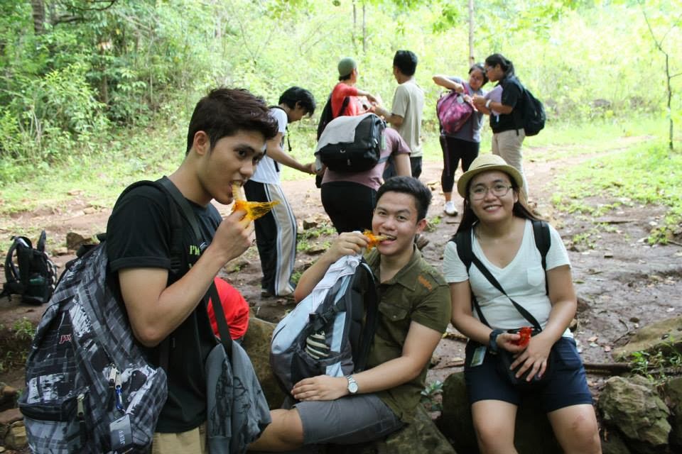
Say hello to my seniors :) Just message me here if you want to get their numbers. They are all single except the leftmost and rightmost girl haha :D


Very lovely. Im referring to the mountain haha :D peace ate :P


Mt. Batulao  is pretty amazing from afar.


Lots of cogon grass on the trails, This was the start of the slowly ascending part of the trail. We continued the trail with caution since you might stumble a few hundred meters below if you are not careful. Based on the available data on the web, there is one person who died and one person who fell on this mountain. The former was because the person was taking pictures resulting to the fall while the latter was due to being drank from alcohol on their way down.


This was the first stop, we had to rest for a bit because the rays of the sun is really dehydrating. You should not worry about having not enough water or drinks because there are a lot of these mini stores along the trail. Thou, the drinks were a little bit pricey.


Just enjoy the sun and the scenery so that you will not feel the tiredness :D


At last we were able to reach peak 1 :) Please take note that there are 8 peaks on Mt. Batulao :D

Mt. Batulao's trail is not that hard, i think the heat of sun is the hardest part of this climb. The trail is also pretty straightforward so im sure no one will get lost and there are a lot of hikers here specially on weekends. My advise for first timers on this mountain is to have a good hiking shoes because the trail is very sandy so you might slip and tends to be muddy during rainy season.


We continued the trail and let nature mesmerized our eyes for the pleasant and wonderful view. 


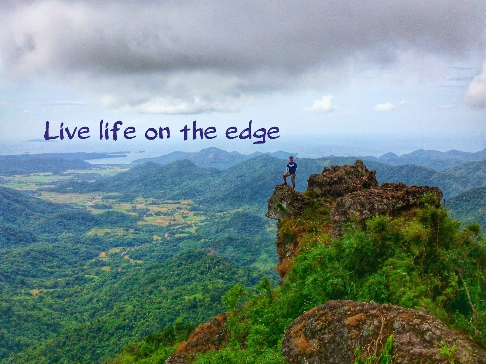
These was one of the notable picture taking spots near the summit. You could actually climb these rocks, you just have to be very careful since a wrong step could cost your life. I actually managed to climb the large boulder on the rightmost part the picture but I could not stand above it because my knees are shaking.


After almost 3 hours of hiking, we made it to the summit :) Cheers to all my seniors for a successful and smooth climb. This was their first time to climb a mountain and I believed their experience here will paved way to more future climbs. The summit offers a 360 degree, dramatic and breathtaking view of the Batangas area. You just want to stare at the scenery for hours and relax at the peak. We took our lunch here and took individual shots. Every place on the peak is good for photo ops so be sure that your camera has still power.


After a tiring hike, we traveled to Tagaytay to have dinner and of course taste the famous Tagaytay Bulalo which was indeed very delicious and satisfied our hungry stomach. Cheers for a wonderful and successful hike :)


Sunday, February 23, 2014

Climbing my first mountain - Mt. Pico de Loro

I really do not know how to start this post but from what i could recall this happened seven months month ago. I'm with my friends who are also my co-officers in our organization during my college days. They were all accountants in the public sector and hence experienced hell season like I did. So I decided to asked them to join me in my nature trip and gladly i received a yes from them. We joined a group of hikers organized by Travel Adventours and that cost us Php 1,400 per person. As first timers, we decided to join an organized tour just to be sure that we could go back home safe and sound haha but you could go to Mt. Pico de Loro at a much lower costs. We arrived at the meeting place (Mcdo at the back of SM Megamall) about 5 in the morning and ate our breakfast. Afterwards, we started our almost 1 hr journey by rented van to Mt. Pico de Loro situated at Nasugbu Batangas. I woke up very early so I took a quick nap and after I opened my eyes we were already at the park station.

Just a brief information on the mountain, Mt. Pico de Loro is 664 Meters Above Sea Level and will take you about 2-5 hours to reach the summit. It is a minor climb with a difficulty level of 3/9 and a trail class of 1-3 (credits to PinoyMountaineer.com). This mountain offers a unique tower of stone at the summit, verdant and green forest, and a 360 degrees magnificent view at the summit. This opened my interest to explore more mountains in the future and might turn a city-boy into a nature-lover boy. Recommended to beginners by most climbers however based on my experienced it was hard haha but definitely worth your every sweat.


This is the signage in front of the park station. There is a parking lot inside, a small eatery, shower rooms, and a registration area. As soon as I stepped out of the van, the cool breeze started to wake up my inner sense of adventure. I left some of my belongings inside the van and just took my dslr camera, 2 liters of water, lunch, and some trail foods. From the park station, you have to walk a few hundred meters to the real jump-off point and from there you'll mostly walk your way up. 


And we started to walk in the muddy land because it rained slighlty while we are on our way to Batangas. It is a good thing that it did not last long enough but still the muddy surface made our journey a little bit annoying. Everytime I stepped on my foot, mud just stuck on my shoes' sole, felt like i am dragging a chain while walking.


Right above is a small portion of that thick muddy part of the trail. 


And after about  45 minutes of ascending trail, it is time to go down carefully. As you can see on the picture above those roots are slippery and of course I do not want my white shirt to drench in mud.


I really thought that it will just be a walk in the park unfortunately I was wrong haha. From this point, it's just a 10-15 mins until the first base camp. Well as for me i drank a lot of water as I'm just very exhausted and my legs started to hurt but it is still bearable. We took a couple of shots as shown below and rested well as the trail ahead will be more challenging and difficult. Upon arriving here, there's a registration sheet btw  don't forget to log the name of your group on the . here is also a sari sari store where you could by refreshments and some souvenirs.


And off we go to the deeper part of the forest. The sun started to peek between the clouds that made the weather a lot hotter.


It is a good thing that the trail we are walking is a forested part and as you can see there are a lot of bamboos along the way and sometimes you have to ducked


And we took our 2nd stop over for a quicm 15mins rest. Well im just really tired at this point and i continued to ask where the hell is the summit haha.


After the quick rest, the trail continue to move upwards with some steep parts and some large boulder of rocks along the way haha as shown below but after that the 2nd base camp is just a not so long walk.


And then you will reach the magnificent view awaiting at the second base camp. The feeling was just so great that i could not feel my legs aching and my body numbing. You will see a very good view of the scenery as shown on my picture below and you really have a lot of places to have your new facebook profile picture and cover photo. 


I felt I was in a very calm place with no problems to think of, no stress from work, I felt like I have no worries to think of just by staring at the view above.


Im on top of the world!! :)) Just kidding :P 


And hell yes this is my most favorite spot, i tried to stand up on that stone unfortunately I got scared haha a little mistake will make you fall a hundred meters below.


Here you could see the summit already. A 20-30 minute of life threatening ascent because that slope is about 60-70 degrees with no ropes, you just have to rely on your self and the tall grass and pray you dont plummet downwards. well i really prayed haha because my legs got cramps while ascending that part and it was just so scary i thought i would fall probably because my shoes just gave up on this point. 


 I have survived and conquered the summit of Mt. Pico De Loro. That american guy beside me helped me carry my bag because he noticed that i was not moving from my place when we assaulted tbe summit. Many thanks to him and to our guide who helped me reaching the summit because i really cant the pain on my both legs were just unbearable. As usual we took a group photo and there it is. While i was busy catching my breath my friends did the jumpshots below i didn't even tried to do it haha probably because of my condition.


Look above, that is the famous rock which i haven't climbed awwww haha if my legs were just in good condition that time i might have been on the top of that big boulder of stone too. Well probably it just meant that i should be back again to this very wonderful place. 


Congrats to me and my friends :)  haha the picture above doesn't show how damn tired we are :p


The view at the summit was just too good i really dont want to go down again haha. Refreshing wind, very nice scenery, I felt very at ease and proud of our group's accomplishment. I'll be back here again i promise :) Lastly, leave no trace of your garbage ok? and have a safe trip going up and down to this mountain.