MT. MACULOT
Cuenca, Batangas
Major Jumpoff: Mountaineer’s Store, Brgy. 7 “Siete”, Cuenca
Exit point (traverse): Brgy 5 (to Grotto), Cuenca
LLA: 13°55 N; 121°2 E; 706 MASL (Rockies) / 930 MASL (summit)
Days required / Hours to Rockies / summit : 1 day / 1-2 hr / 2-4 hr
Specs: Minor, Difficulty 3/9 (Rockies); 4/9 (Traverse) Trail class 1-3.
Features: Scenic views of Taal Lake, rock formations, forests
Source: pinoymountaineer.com
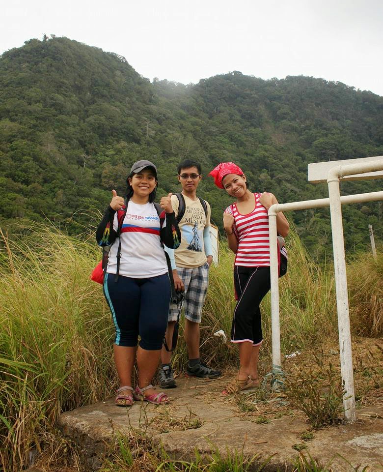
Most hikers/mountaineers often say that newbies must first conquer the three "easiest" and most popular mountain before stepping up to more difficult climbs. I have climbed the first two, Mt. Pico de Loro and Mt. Batulao. Thus, I decided to conquer the last mountain which I considered an "eye opener", Mt. Maculot. The mountain is just 2-3 hours away from the metro making it a good weekend destination. It was a pleasant Saturday morning when we boarded a DLTB bus bound to Lemery. This was my first climb with my new hiking friends, ate Jen and her friend Ate Ems. I met Ate Jen in a forum site for CPA way back when I was still reviewing for my board exam and found out that Ate Jen also met Ate Ems on that same site. Indeed, it was a small world after all. The bus was packed with other mountaineers which I suspected going to the same mountain we're heading or to other mountains in the south. I slept soundly during our bus ride to gather strength and woke up almost near the quiet town of Cuenca, Batangas. I was not quite sure where to exactly get off the bus but my instinct told me to just follow whenever a group of hikers will get off. So when the bus conductor shouted "Cuenca" and other group of mountaineers started to stand up from their seats, then I immediately told my companions to get off also. We saw a bunch of tricycles lined up along the street. I asked one of the drivers to bring us to the registration area of Mt. Maculot then we're off. After a few minutes, we arrived at the said area and logged our names, secured a guide which happened to be a Barangay official and left an id to them.


We arrived at the jump-off area a few minutes after. There is a store nearby where you can have your breakfast first before starting the climb and it has a restroom/shower area also. I felt a sudden stomach discomfort and luckily, there was a nearby store with a comfort room where I could flush out any bad spirit lol, but there was none. Maybe because I felt nervous during that time. Once we're all set, we now started our journey to the mountain.
The start of the trail is marked with a signboard. After a few minutes, you will now walk in a dirt road. The level of inclination increases as you walk further and further. The trail is well maintained and I honestly believe guides are unnecessary if you had been here many times already and your destination is only straight up to the "Rockies" area. However, in our case we will do a traverse climb on this mountain in which we will ascend first to the "Rockies" up to the "Summit" then descend via the "Grotto" route. Thus, getting a guide is a must since there were already confusing trails past the "Rockies" area. Unfortunately, the guides are mandatory now even if your destination is only up to the Rockies. Based on what I can recall, there are 2 sections until the Rockies. The first part is the forested area wherein the trail is a continuous assault in a loose soil terrain. There were various bamboo-made resting areas along the trail so you should just take your time and catch your breath on these areas. This will pose a challenge to beginners since it is quite a heart pounding task to get through this section.
Afterwards, your reward is a major resting area where you can now have an initial glimpse of the Taal Lake, was coming our way. It was a little bit cloudy when we got up there so we did not saw the bluish waters of Taal Lake but nonetheless, it was still beautiful. We rested for quite some time to regain our strength since the next phase into the Rockies will be more difficult.


The next phase of the trail going to Rockies is the "talahib" trail, wherein you will be expose directly under the heat of the sun while walking through tall talahib grasses. You will now be able to see the town of Cuenca and the other forested parts of Maculot. We did not stayed on this area for long since it was hot and humid. We just took some shots and continued our ascent.
Once we completed the talahib trail, we entered the forested area again wherein the trail went upwards for a bit and then suddenly it went downwards until we reached the dangerous part of the trail. It is dangerous since only one person at a time can fit the narrow trail and deep ravine lies on both sides. There were lots of persons lined going up the rock scrambling part of the trail so we just slowed down our pace and took our time to ensure safety.
 |
| This is the view of the Rockies while the trail continued downwards. |
 |
| This section is near the dangerous short ridge before going up the Rockies. |
 |
| I'm now standing at the middle of the ridge. Showing here is the rock scrambling part of the Rockies which is the steepest and most dangerous part of the trail. The grassy area on my left and right hides the dangerous ravine. |
 |
| I'm sitting at the edge of the trail. Just a wrong move and I'll end up several hundred meters below lol. Try not to look down. |
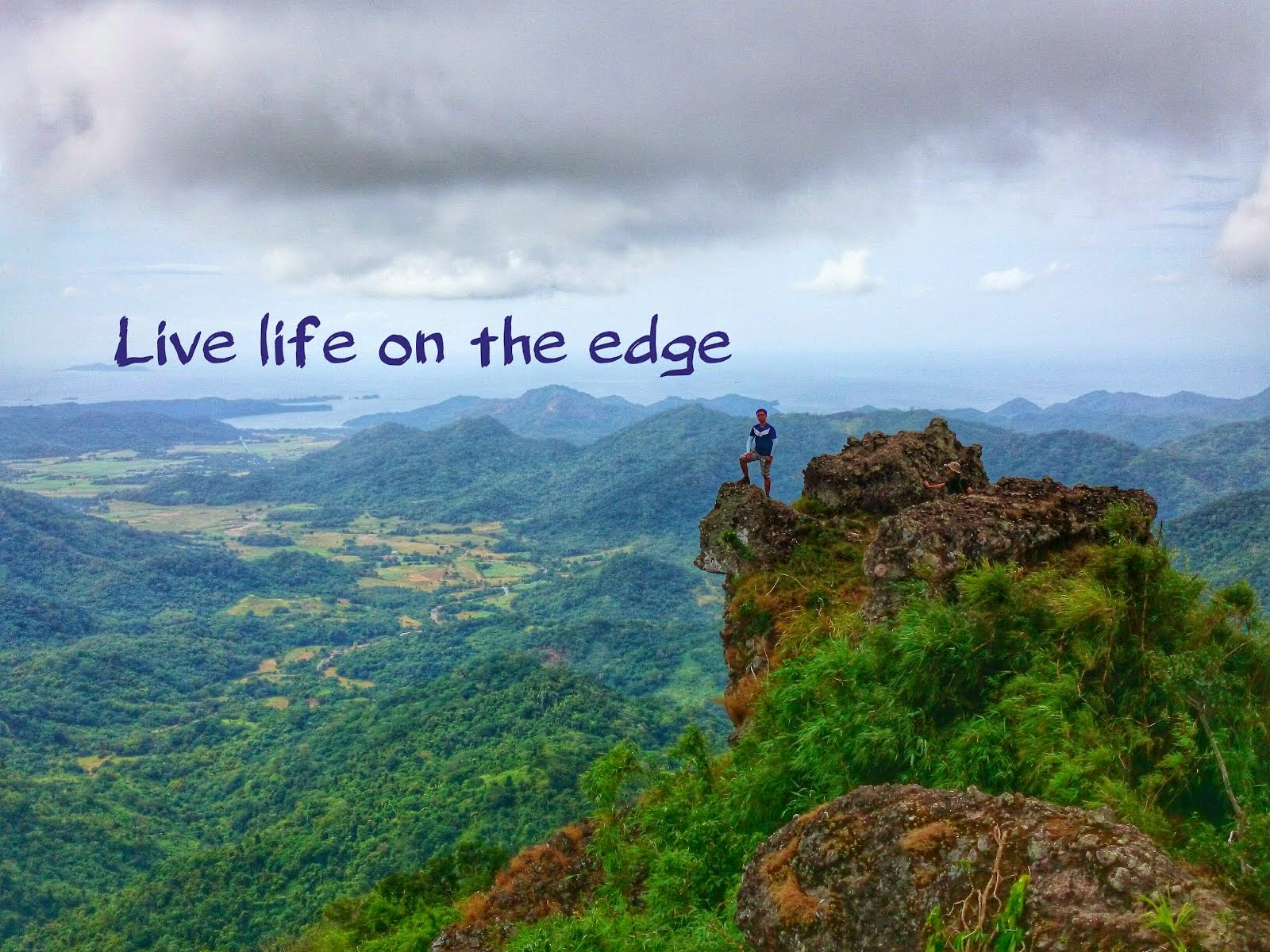
Shown above, is a picture of me sitting on the edge of a rock at the halfway mark of the rock scrambling section to the Rockies. You can clearly see the downward narrow trail going to the short ridge below. You can only go upwards and continue working your way through the big rocks only if there are no persons going down. The trail is narrow so you just have to wait for your turn. I found it hard to navigate if you have short limbs since there will be no additional support when you use your upper body strength to lift your body up the rocks. Once we're done with this difficult section, we were rewarded with breathtaking views of the Taal Lake. There were lots of people on the Rockies so you just have to wait for your turn to get a good photo spot for your solo picture.
 |
| You just have to be mindful of the places you're standing at to ensure that you'll not end up swimming at the lake lol. |
 |
| At the background is the forested summit of Mt. Maculot, a 2 to 3 hour hike from the Rockies. |
After our eyes we're satisfied with the view, we went down the Rockies and continued our ascent to the summit. The trail going to the summit was much harder but more manageable since the soil was not loose and there we're lots of branches to hold on to. There were also times when we had to duck our heads in order to navigate the trail. After about 2 to 3 hours of upward trail, we arrived at the summit where you can only have a glimpse of the Rockies and some view of the of the Taal Lake. I liked it this way, since this was the natural and original arrangement at the summit. Unfortunately, the local authorities cut some overgrown plants at the summit to give hikers a better view which I find to be unnecessary.
 |
| View at the summit of Mt. Maculot |
 |
| Yes! I conquered my third climb. Completed the beginner's trio! Pico de Loro, Batulao and now Maculot! |
Since the summit only offered a limited view and not much can be done, we just went ahead and started the long and painful way back down. Getting down is always the hardest part of every climb since your legs are already tired. In my case, I had a difficulty getting down because I already felt my legs were about to experience cramps. Luckily, it did not push trough. The highlight of the climb back down to the Grotto was the portion where we had to rappel. I really enjoyed it since it was a lot easier than what is shown on the pictures below.


.jpg)
After a few hours, we finally emerged out of the woods and finally saw a glimpse of the Grotto. There was some huts few meters below the Grotto so we rested for a while. Then, we continued another uphill battle to the Grotto where you can see the towns below and the summit at your back. I stopped for a while and prayed to the Lord to give me strength to finish the hike since my legs back then were already painful. The most painful part of the climb was the concrete staircase going downward from the Grotto. The stairs were placed close to each other so it was really tiring on my legs. Fortunately, we all managed to get back down the mountains safely and enjoyed a delicious lomi back at the jump-off point. Yehey!
 |
| Oh no.. Another uphill trail to the Grotto as seen from the resting huts below. |
 |
| Mt. Maculot summit (upper left portion) as viewed from the Grotto. Cheers to the team! |
 |
| Kuya Jose, our guide, and ate Ems. |


.jpg)