Showing posts with label Explore Philippines. Show all posts

Friday, February 5, 2016

3rd Climb - Mt. Maculot Traverse - Rockies - Summit - Grotto


MT. MACULOT
Cuenca, Batangas
Major Jumpoff: Mountaineer’s Store, Brgy. 7 “Siete”, Cuenca
Exit point (traverse): Brgy 5 (to Grotto), Cuenca
LLA: 13°55 N; 121°2 E; 706 MASL (Rockies) / 930 MASL (summit)
Days required / Hours to Rockies / summit : 1 day / 1-2 hr / 2-4 hr
Specs: Minor, Difficulty 3/9 (Rockies); 4/9 (Traverse) Trail class 1-3.
Features: Scenic views of Taal Lake, rock formations, forests
Source: pinoymountaineer.com

Most hikers/mountaineers often say that newbies must first conquer the three "easiest" and most popular mountain before stepping up to more difficult climbs. I have climbed the first two, Mt. Pico de Loro and Mt. Batulao. Thus, I decided to conquer the last mountain which I considered an "eye opener", Mt. Maculot. The mountain is just 2-3 hours away from the metro making it a good weekend destination. It was a pleasant Saturday morning when we boarded a DLTB bus bound to Lemery. This was my first climb with my new hiking friends, ate Jen and her friend Ate Ems. I met Ate Jen in a forum site for CPA way back when I was still reviewing for my board exam and found out that Ate Jen also met Ate Ems on that same site. Indeed, it was a small world after all. The bus was packed with other mountaineers which I suspected going to the same mountain we're heading or to other mountains in the south. I slept soundly during our bus ride to gather strength and woke up almost near the quiet town of Cuenca, Batangas. I was not quite sure where to exactly get off the bus but my instinct told me to just follow whenever a group of hikers will get off. So when the bus conductor shouted "Cuenca" and other group of mountaineers started to stand up from their seats, then I immediately told my companions to get off also. We saw a bunch of tricycles lined up along the street. I asked one of the drivers to bring us to the registration area of Mt. Maculot then we're off. After a few minutes, we arrived at the said area and logged our names, secured a guide which happened to be a Barangay official and left an id to them.


We arrived at the jump-off area a few minutes after. There is a store nearby where you can have your breakfast first before starting the climb and it has a restroom/shower area also. I felt a sudden stomach discomfort and luckily, there was a nearby store with a comfort room where I could flush out any bad spirit lol, but there was none. Maybe because I felt nervous during that time. Once we're all set, we now started our journey to the mountain.

 
The start of the trail is marked with a signboard. After a few minutes, you will now walk in a dirt road. The level of inclination increases as you walk further and further. The trail is well maintained and I honestly believe guides are unnecessary if you had been here many times already and your destination is only straight up to the "Rockies" area. However, in our case we will do a traverse climb on this mountain in which we will ascend first to the "Rockies" up to the "Summit" then descend via the "Grotto" route. Thus, getting a guide is a must since there were already confusing trails past the "Rockies" area. Unfortunately, the guides are mandatory now even if your destination is only up to the Rockies. Based on what I can recall, there are 2 sections until the Rockies. The first part is the forested area wherein the trail is a continuous assault in a loose soil terrain. There were various bamboo-made resting areas along the trail so you should just take your time and catch your breath on these areas. This will pose a challenge to beginners since it is quite a heart pounding task to get through this section. 


Afterwards, your reward is a major resting area where you can now have an initial glimpse of the Taal Lake, was coming our way. It was a little bit cloudy when we got up there so we did not saw the bluish waters of Taal Lake but nonetheless, it was still beautiful. We rested for quite some time to regain our strength since the next phase into the Rockies will be more difficult.


The next phase of the trail going to Rockies is the "talahib" trail, wherein you will be expose directly under the heat of the sun while walking through tall talahib grasses. You will now be able to see the town of Cuenca and the other forested parts of Maculot. We did not stayed on this area for long since it was hot and humid. We just took some shots and continued our ascent.


Once we completed the talahib trail, we entered the forested area again wherein the trail went upwards for a bit and then suddenly it went downwards until we reached the dangerous part of the trail. It is dangerous since only one person at a time can fit the narrow trail and deep ravine lies on both sides. There were lots of persons lined going up the rock scrambling part of the trail so we just slowed down our pace and took our time to ensure safety.

This is the view of the Rockies while the trail continued downwards.
This section is near the dangerous short ridge before going up the Rockies.
I'm now standing at the middle of the ridge. Showing here is the rock scrambling part of the Rockies which is the steepest and most dangerous part of the trail. The grassy area on my left and right hides the dangerous ravine.
I'm sitting at the edge of the trail. Just a wrong move and I'll end up several hundred meters below lol. Try not to look down.

Shown above, is a picture of me sitting on the edge of a rock at the halfway mark of the rock scrambling section to the Rockies. You can clearly see the downward narrow trail going to the short ridge below.  You can only go upwards and continue working your way through the big rocks only if there are no persons going down. The trail is narrow so you just have to wait for your turn. I found it hard to navigate if you have short limbs since there will be no additional support when you use your upper body strength to lift your body up the rocks. Once we're done with this difficult section, we were rewarded with breathtaking views of the Taal Lake. There were lots of people on the Rockies so you just have to wait for your turn to get a good photo spot for your solo picture.


You just have to be mindful of the places you're standing at to ensure that you'll not end up swimming at the lake lol.
At the background is the forested summit of Mt. Maculot, a 2 to 3 hour hike from the Rockies.


After our eyes we're satisfied with the view, we went down the Rockies and continued our ascent to the summit. The trail going to the summit was much harder but more manageable since the soil was not loose and there we're lots of branches to hold on to. There were also times when we had to duck our heads in order to navigate the trail. After about 2 to 3 hours of upward trail, we arrived at the summit where you can only have a glimpse of the Rockies and some view of the of the Taal Lake. I liked it this way, since this was the natural and original arrangement at the summit. Unfortunately, the local authorities cut some overgrown plants at the summit to give hikers a better view which I find to be unnecessary. 

View at the summit of Mt. Maculot
Yes! I conquered my third climb. Completed the beginner's trio! Pico de Loro, Batulao and now Maculot!
Since the summit only offered a limited view and not much can be done, we just went ahead and started the long and painful way back down. Getting down is always the hardest part of every climb since your legs are already tired. In my case, I had a difficulty getting down because I already felt my legs were about to experience cramps. Luckily, it did not push trough. The highlight of the climb back down to the Grotto was the portion where we had to rappel. I really enjoyed it since it was a lot easier than what is shown on the pictures below.


After a few hours, we finally emerged out of the woods and finally saw a glimpse of the Grotto. There was some huts few meters below the Grotto so we rested for a while. Then, we continued another uphill battle to the Grotto where you can see the towns below and the summit at your back. I stopped for a while and prayed to the Lord to give me strength to finish the hike since my legs back then were already painful. The most painful part of the climb was the concrete staircase going downward from the Grotto. The stairs were placed close to each other so it was really tiring on my legs. Fortunately, we all managed to get back down the mountains safely and enjoyed a delicious lomi back at the jump-off point. Yehey!

Oh no.. Another uphill trail to the Grotto as seen from the resting huts below.
Mt. Maculot summit (upper left portion) as viewed from the Grotto. Cheers to the team!
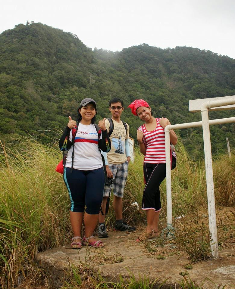
Kuya Jose, our guide, and ate Ems.

Saturday, April 4, 2015

8th Climb - Mt. Pamitinan


Mt. Pamitinan
Rodriguez, Rizal
Major jumpoff: Brgy. Wawa, Rodriguez, Rizal
LLA (Pamitinan): 14°43′51.7′′N 121°11′29.2′′ E 426 MASL
Days required / Hours to summit: 1 day / 1.5-3 hours (P)
Specs: Minor, Difficulty 4/9 / Trail class 1-4
Features: Limestone formations, scenic views of Sierra Madre and Rizal province
Source: pinoymountaineer.com


I was not able to slept soundly the night before our scheduled hike. I was quite nervous because of the hardship I experienced during our Mt. Binacayan day hike. I don't want to underestimate this mountain even though based on the blogs that I have read, Mt. Pamitinan is easier compared to Binacayan. Our meeting place and time was still the same, 4 am at Mcdo, Gateway Cubao. I did not noticed that I set my alarm at 3:45 am (probably due to nervousness) so I woke up late haha. I was agitated because I knew that I won't be able to arrive at the scheduled time. Of course, it was quite disgraceful since I was the one who reminded them to arrive as early as possible. Moreover, I felt that a storm was brewing in my belly haha. I was able to reduce some of my heavy baggage but I felt that it still wasn't enough haha.

I started my journey thinking that all was going to be well. Firstly, I went to Sm San Lazaro to fetch ate Jean Kaye because we were going to the meeting place at the same time. I felt uncomfortable while we were on the road but I just told myself that I'll be able to make it to Mcdo. Every second seemed so long so I was silent and just tried my best to focus and conserve energy and not think about my hidden problem haha. We arrived after almost 30 minutes at Mcdo and went directly to the cashier to order some food. I opened my bag and noticed that my cellphone was missing. I had a feeling something bad was going to happen so I searched every corner of my bag but to my disappointment, it wasn't there. My mind went into panic mode so I immediately went to our table and started to search my bag over and over again until I realized that I left it on the taxi we rode. I'm glad that ate Jean Kaye was there to help me calm down. I was really depressed that time because I have already lost two things years ago. I lost my ipod touch the first time when I went home early morning due to overtime at work. Then, I lost another one, my samsung s4 to bad guys. I was already thinking to stop the hike because of the misfortunes that early morning until the taxi driver answered our call. The heaven suddenly opened up when the taxi driver told us that he will return my cellphone. We immediately went outside to the place where the taxi driver dropped us off. The taxi arrived several minutes later and we raised our hands joyfully to welcome the taxi driver. I hastily approached the taxi, opened the front door, said lots of thank you to him and paid his good deed. I immediately thanked the Lord that there are still good people out there. We went back inside Mcdo and waited for the others.

Wilhelm arrived several minutes later. Then, Ebol and her bf Eric came.

We went to queue up for the fx across the street since we were all there and then our long trip began. Our trip took us almost 2 hours to Eastwood, Rizal because of traffic. It was palm Sunday so many devotees were flocking to churches and conducting religious processions. I felt that the storm in my stomach was intensifying due to the long trip.

It was almost past 8 am when we arrived at the DENR outpost in Brgy. Wawa. I swiftly went to the bathroom but was horrified to see lots of females queued up. I cannot paint my face back then due to the pain I felt. At last, my glorious moment arrived when I was next in line. I executed my evil plan and went out of the bathroom gasping for air haha. At last, I felt okay and ready to start the hike.

The officer in charge told me that kuya Gerry already went up Pamitinan so she gave us another guide by the name of Alvin. He is quite young and I think he is only older than me by a few years. He is also a DENR guide but he is quite new to the business. 

We started our hike at aroung 8:30 am. The left way is to Pamitinan while the right is bound to Binacayan. We passed by some houses until we arrived at a hanging bridge. Alvin told us to pray first, one thing that I forgot to do. After a brief prayer, we started to cross the bridge. This is the place where you could take a photo of both Binacayan and Pamitinan. They said that these depicts the old tale of Bernardo Carpio, a man that was crushed by two boulders. The left, easier and higher one is Mt. Pamitinan while the right, lower and more difficult one is Mt. Binacayan.


The next part of this trail are concrete stairs all the way up that served as a warm up for all of us. The trail was quite easy and more comfortable as there were lots of trees to protect us from the rays of sun. We continued walking with a quick rests along the way since Ebol is panting already. This was maybe due to the heavy backpack she had. Eric volunteered to carry her backpack all the way. How sweet hehe :) Actually, I prefer to have lots of break since it wasn't that hot back then and so that we can have a relaxing pace.


We arrived at a place where a grand balete tree stands. According to Alvin, this is the sturdiest and tallest tree in the place.


We continued our journey after a brief picture taking on the grand balete tree, as seen on the above picture. We reached the area with huge limestone formations where lots of people can do rock climbing.


There were a lot of climbers on this mountain because it is much easier compared to Binacayan so you'll encounter more traffic on this area. We soon entered an open area where you can already witness the beauty of the surrounding areas. This is the starting point where you should start wearing gloves and take more cautious steps at all times.


The picture above is Mt. Banoi. Our guide told us that it is climbable but the trail is long.

We continued our way up pass the boulders until we reached a picturesque area. We stayed here to take photos since there were still climbers ahead of us.


Ate Jean Kaye doing her signature pose. 


Me while searching for stable path haha.


The weather was fine and the scenery was good. Just perfect for a good adventure and picture :) 


That is our guide Alvin. I'm thankful that he is very skilled and does not hesitate to help us climb those unforgiving rocks haha. Traffic continued to build up as we head near the summit. After this open area, we were back again under the shades of the trees. There is a vertical rock formations that you will encounter afterwards. This is my most favorite part of the trail. Unfortunately, I was not able to get a picture of it. We stopped for quite some time because the next area for picture taking is quite narrow. The group ahead of us spent lots of time there so we were able to get plenty of rest. We also met the group of Sir Gerry. He was surprised because he thought that we will not continue our hike that day. He told us that he left his cellphone so he was not able to confirm to me that he will be our guide. After quite some time, the group ahead went forward so it was now our time to enjoy another breathtaking and death defying picture taking area.


All I can say is that this was the most perilous photo spot that I had been to haha. My legs did not stop shaking especially when I looked down below. This area is quite narrow and I think it can only accommodate few people at a time. Super extra caution must be taken when going to this strip of rock. I was supposed to do some daredevil poses in this area but decided to just go in the safe zone haha.


The summit is just a few meters away from this area so we packed up and move forward. There were many hikers waiting in line just below the summit to escape the intense heat of the sun. We spent our time underneath some boulder of rocks.


There it is the summit of Mt. Pamitinan :)


We are currently waiting for our turn to the summit of Pamitinan. This is a good place to sleep haha the air is cold in this place.


Behold the cordilerra mountain ranges :) I was supposed to stand on the rock formations on the above picture but the wind was too strong. I feared that I'll stumble so I did not pushed through with my plan.


Freedom! :) This is exactly the reason why I love climbing mountains. The feeling of getting out of your comfort zone. The feeling of being alive.

And at last, the last group descended on the summit and it's now our turn to taste the sweet victory of this climb :) Just a little bit of rock climbing and voila! we are now on the summit of Mt. Pamitinan. Cheers for a successful climb guys!


Yes, that is Mt. Binacayan. The mountain that made me feel like a lame duck haha. We descended the summit at around 1 pm and continued to make our way back down quickly since it was already getting late. We still have to go to Wawa Dam as a side trip for this climb. We safely arrived at the jump off point to eat lunch. My legs cramped when we were on our way to Wawa Dam so I decided to just stay at the tourism office with ate Jean Kaye. Our three peers continued the side trip. We took our last shot before saying goodbye to Brgy. Wawa and the two gorgeous mountains.


Thank you guys for accompanying me to this trip :)

See you on April for more adventures :)

Actual expenses excluding food:
FX to Eastwood, Rizal and back - 100 pesos
Tricycle to Brgy Wawa - 10 pesos
Guide Fee - 200 pesos (discretionary payment)
Jeep back to Eastwood, Rizal - 8 pesos
Total expenses - 318 pesos